The Exploration Targeting Platform
The geoscience behind
every target.
TerraEye brings satellite, geophysics and geochemistry into one workspace, then looks for the ground where they agree. Here is how each one works, and how 2.0 puts them together.
Want to see it in the product? See the Platform page →
The idea
From the whole licence to a target you can defend.
Exploration is a narrowing problem. You start with too much ground and too little budget, and each kind of data takes a layer of risk out, until what is left is a short list of targets you can stand behind.
01 / Remote Sensing
Spectral
Every project starts with the satellite. We read the light reflected off your ground across dozens of wavelengths, far more than the eye can see, and turn it into maps of the minerals and structures below.
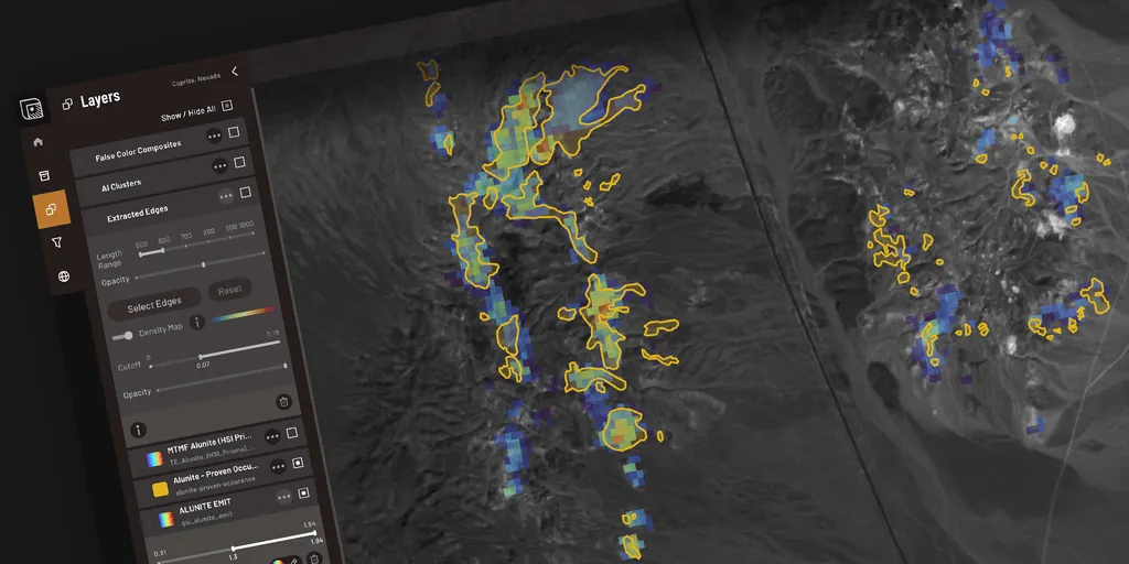
Every pixel carries a spectral fingerprint. We match it against the spectral library to map alteration minerals like kaolinite, alunite and iron oxides, the tell-tales of a mineral system. SFF fits each mineral's diagnostic absorption features one by one — the most precise spectral match in the platform — and SAM cross-checks the whole spectrum. Together they keep false positives down.
Band-ratio indices tuned to specific minerals and alteration zones, so you can light up gossans, argillic alteration or laterites across a whole licence in seconds.
Vegetation hides the rock. We composite years of imagery to recover bare-ground pixels between the leaves, adding up to 20% more mappable ground where a single scene would write it off.
Where you cannot see the rock at all, you can read the plants. Metals in the soil stress vegetation in the near-infrared. This is the method an independent team ranked the strongest predictor of high-grade nickel in the Ring of Fire. Read the primer →
We trace the linear structures in the terrain from the elevation model, because faults and fractures are the plumbing that carries mineralising fluids.
02 / New in 2.0
Geophysics
2.0 brings your geophysics into the same view as the satellite. The satellite reads the surface; geophysics reads what sits beneath it. Together they tell you whether a surface anomaly has a body under it worth chasing.
Load your airborne or ground magnetic surveys — or pull global public data such as the EMAG model — and TerraEye computes the standard magnetic transforms and displays them beside your spectral layers, with a depth slider. The geological reading stays with your geologist.
Because every layer is registered to the same ground, you can overlay a magnetic anomaly on a spectral anomaly and a structural intersection and see the coincidence for yourself. A coincidence of three independent methods is a far stronger target than any one alone.
03 / New in 2.0
Geochemistry
Soil chemistry is the closest thing to ground truth short of a drill hole, and 2.0 brings it in too. It is the layer that confirms, or quietly kills, a target the other methods suggested.
Bring in your soil sampling and overlay it on everything else, registered to the same ground. A geochemical anomaly sitting under a spectral one is a target you can take to the field with confidence. New in 2.0.
We tie the vegetation-stress signal to your soil values, which separates a real metal anomaly from plants that are simply short of water. It is how you explore under cover without fooling yourself. Available as a commissioned study.
04 / Integration
From layers to a ranked target list.
On their own, each layer is a clue. Together they are a case. This is the part that turns a stack of maps into a ranked list of targets.
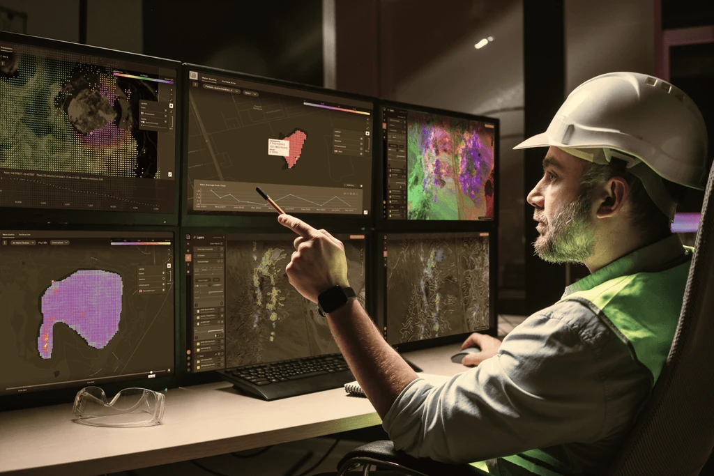
Every layer lives in one workspace, registered to the same coordinates, so you can see the relationships between them instead of flipping between five file formats and three consultants' reports.
Point TerraEye at a deposit you already understand and it looks for ground elsewhere with the same signature. Save any curve to your Spectral Library and reuse it as the reference in a completely different project. And before a candidate reaches your target list, inspect its spectral curve against the reference library — comparing pixels inside and outside the zone — so a false positive is caught at your desk, not in the field.
05 / Defensible
Built for QP sign-off.
A target is only useful if you can defend it. Everything above is built to be checked, not just trusted.
Every target traces back to its source spectra and the physics behind it, in the form a qualified person needs to see. There is no black-box score to take on faith.
Outputs are auditable for your qualified person and export clean into the GIS you already work in, including QGIS, Leapfrog and ArcGIS.
06 / What you can commission
From method to deliverable.
The same toolkit is packaged as discrete, scopeable deliverables. Order one as a stand-alone study, or combine several into a full targeting workflow.
Outcrop & bare-earth mapping
Recover exposed rock under snow, ice and partial vegetation with a multi-year Sentinel-2 Bare Earth Composite, masking and Spectral Similarity Analysis against your reference outcrops.
Property-scale alteration mapping
Map iron-oxide, clay and sericite alteration across a licence from multispectral and hyperspectral data, with the spectral evidence behind every phase.
Regional hyperspectral targeting
Screen a whole region with EMIT, EnMAP and PRISMA plus AI to a ranked short list of structural corridors worth walking.
Multi-data fusion targeting
Fuse satellite with your own magnetics, gravity and geochemistry into one ranked, explainable target set with a per-target rationale and GIS-ready geometry.
Metal-stressed vegetation screening
Read the forest where you cannot see the rock, flagging where vegetation behaves anomalously over buried mineralisation.
Ground monitoring (InSAR)
Track millimetre-scale ground movement over time for slopes and tailings on sites you already work — well beyond targeting.