Our clients






















Why TerraEye
There's always more ground than budget.
A single drill hole can cost more than a whole season of data, so committing to the wrong ground means the money is gone with nothing to show the board.
Finding anomalies is the easy part, because there are always plenty of them. The real question is which ones are worth testing on the ground, and that call stays yours, made with the evidence in front of you.

Faster field planning
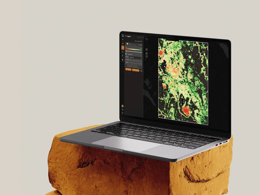
What used to take four weeks of planning can take one, so the team reaches the right ground before the season closes.


Within your requirements
Evidence you can defend — Every target traces back to its source data and the physics behind it — evidence you can review.

Fewer false positives
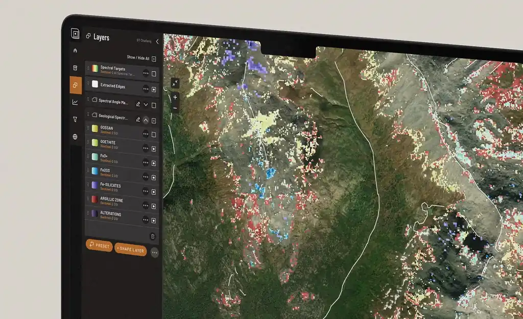
Lay your satellite, geophysics and geochemistry over the same ground and see where the signals line up — so you chase fewer dead ends and spend the budget where the evidence agrees.
new in 2.0
Now TerraEye reads more than the satellite.
The first version turned satellite imagery into mineral maps. The latest release brings your geophysics and geochemistry into the same workspace, so a target no longer rests on one kind of data. It is the difference between one opinion on your project and all of them in one place.
- 6,000+
- minerals in the library
- 3-in-1
- satellite, geophysics, geochem
- Auditable
- traceable to source data

 new
newFrom flat maps to full 3D
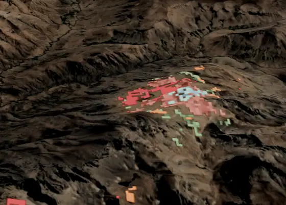
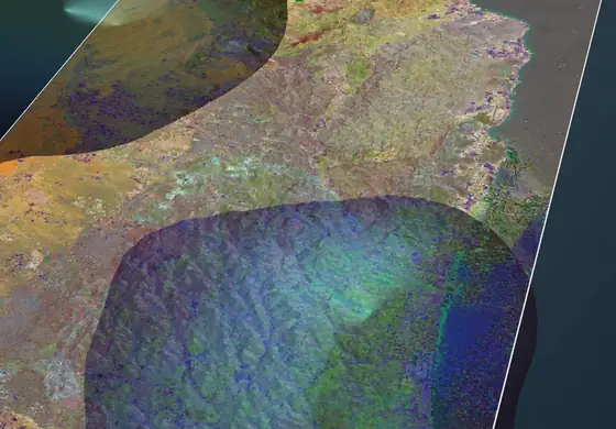
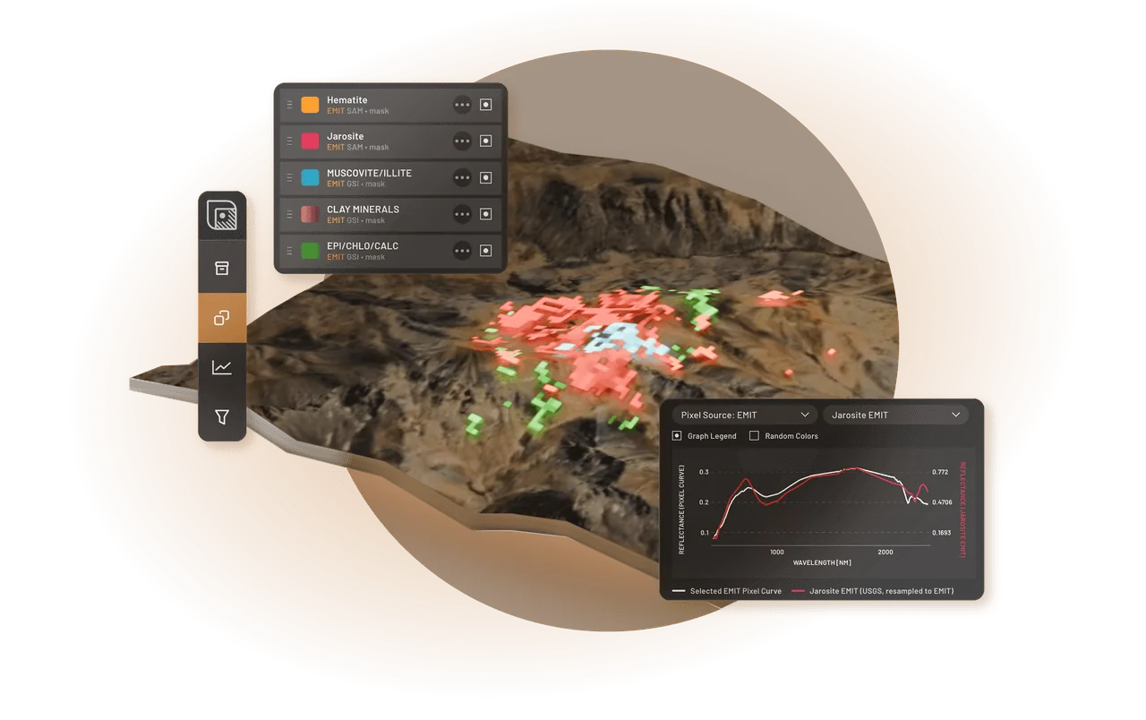
TerraEye is now a 3D platform. Flip any workspace from 2D to 3D and every layer, including the data you brought yourself, drapes over the real terrain.
New 3D engine
 improved
More precise mineral matching
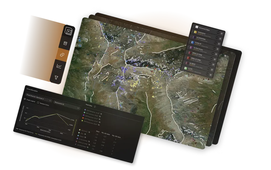
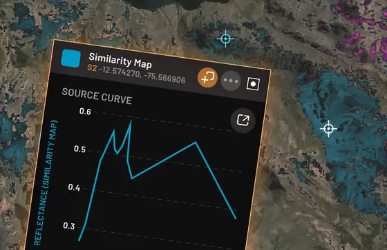
Mineral matching now runs on SFF, the most precise matcher in the platform, with SAM as a cross-check. You can display and compare spectral curves side by side, and in the Analogy Lab you can hunt for spectral analogues using pixels from deposits you know first-hand.
SFF · spectral curves · Analogy Lab
 new
newBeyond satellite, and greenfield-ready
Magnetics, gravimetry and geochemistry now sit beside your spectral layers. Starting a greenfield with nothing on file? TerraEye gathers the basics for you: Sentinel-2, ASTER and EMIT imagery plus global magnetics, gravity and topography, aggregated automatically for your area.
Multi-data workspace · automated greenfield setup
 new
newIgnacy got a team, and hands
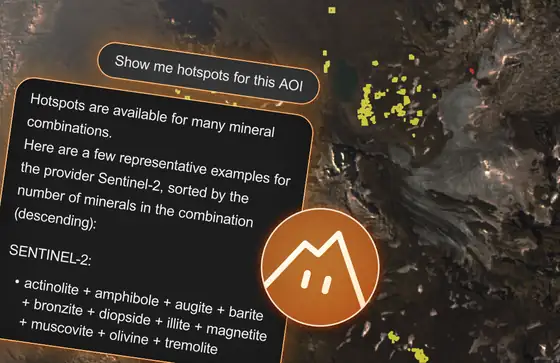
Ignacy, the in-app assistant, now manages a team of AI specialists: a geologist, a spectral geologist and a TerraEye guide. He also works the platform for you. Ask him to add layers, shift thresholds in bulk or swap one mineral hypothesis for another, and the map follows.
Ignacy · agent manager + AI team
 new
newTargets where the evidence overlaps
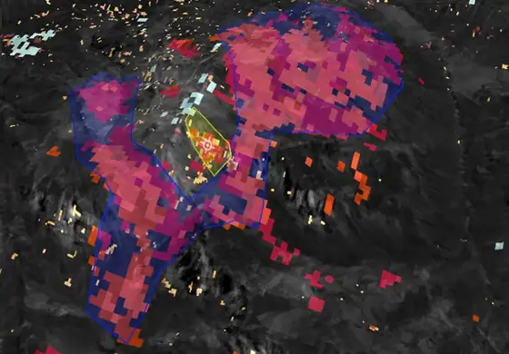
Bring your satellite, magnetics and geochemistry onto the same ground and stack them. Where independent layers light up in the same place, you have a target worth testing, and TerraEye keeps every layer registered, thresholded and ready to read.
Multi-layer targeting
 new
newYour workflow, always at hand
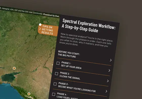
A right-side panel keeps the whole interpretation workflow open while you work: set up the area, clean the signal, load and tune the layers, validate, document. You always know where you are and what comes next.
Guided Exploration Workflow
how it works
See all your data in one view,
and let the targets stand out.
01
Load Your Data
Add your satellite, geophysics and geochemistry to a single workspace, instead of stitching the results together across five different tools and three consultants.
02
See Where They Overlap
When you line the datasets up, the picture gets clearer. A single anomaly might be noise, but when three of them land on the same ground, you have a target worth testing in the field.
03
Rank and defend your targets
You rank the targets; every one traces back to the satellite, geophysics and geochemistry behind it, in a form your qualified person can review and sign off on.
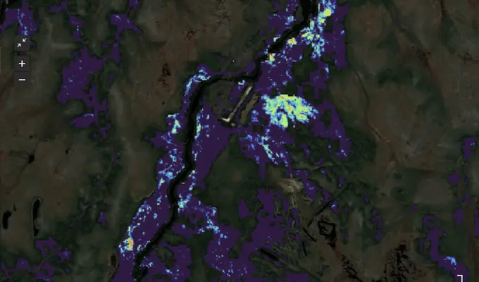
Red Dot 3D · Northern Ontario
Ring of Fire
We read the forest itself, picking up the stress that buried metals put on the vegetation from years of satellite imagery.
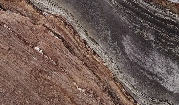
Norway · with EUSPA
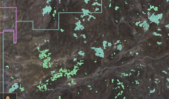
Kuniko
Our Bare Earth Composite picked out the patches of exposed soil scattered through the forest, and follow-up soil sampling confirmed iron-mineralization where we had mapped it. Published with EUSPA.
Sonora, Mexico
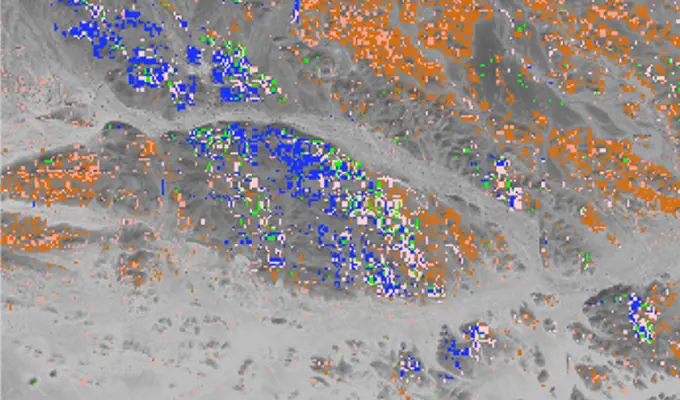
Colibri
We fused four four multispectral and hyperspectral satellite missions with the client's own data and delivered ranked mineral potential targets. Field validation ahead.
Kuya Silver · Rakbah Plain, Saudi Arabia
Umm Hadid
Working entirely from orbit, TerraEye built an independent targeting layer for Umm Hadid, a short list of structural corridors worth testing on the ground.
Read more about the above case studies and explore others. See all Case Studies →
Partnership
Partnership
Testimonials
Explorers who have put it to work.
How we work
Run it yourself, or have us run it for you.
Software
Work in the platform
Your team works directly in TerraEye: draw the area, pull the layers, run analyses and build your own interpretation — guided by the built-in workflow, with Ignacy at your side and a named geologist on call. Export to your GIS when you are done.
Best when your geologists are in-house.
Insights
Get the targets back
Our team runs the analysis for you: satellite first, with your geophysics, geology and geochemistry layered into the interpretation — and hands back a ranked set of targets with the evidence behind them, ready to take to your board.
Best when you would rather have the answer than build it.
Who it's for
Built for the people who answer for the exploration budget.
It is made for the people deciding where the next program goes, and for the ones who have to defend that decision. They usually have more ground than budget, a board that wants proof, and a single season to get it right.
Defensible
Every target shows its work.
A lot of AI tools simply hand you a score and ask you to trust it. TerraEye shows the satellite, geophysics and geochemistry behind every target, in the form a qualified person needs to see, so it is the kind of call you can take to your board with confidence.
One workspace
Everything in one place, instead of five.
Rather than moving between separate tools and several consultants, you keep your satellite, geophysics and geochemistry together in one workspace where the layers actually work with each other. When you are done, you can export cleanly into the GIS you already use.
pricing
Start small, and see what it does on your own ground.
Software plans that grow with you, from a single licence to a full portfolio. Delivery studies are priced separately.
Prefer we run the analysis, or need a portfolio framework? See full pricing →