pricing
Priced against a wasted hole,
not a software seat.
Two clean ways to work with TerraEye. License the platform and run targeting yourself, or have us deliver the analysis as a report. Software is priced as software; delivery is priced on the outcome. Every published number is a starting point, not a gate.
Pillar 1 — Platform · software, recurring
License the software, run it yourself.
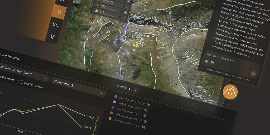
Your geologists work directly in TerraEye: draw the area, pull the layers, run AI Spectral Targeting and build your own interpretation — guided by the built-in workflow, with Ignacy at your side. Export to your GIS when you are done. Each tier is a base subscription plus included capacity (seats + active area) and a capability set. No analyst-delivery hours are bundled in — that lives in Pillar 2.
Scout
$9,700/yr
or $970 / mo
For a single geologist working one property.
Explorer
most popular$33,900/yr
or $3,290 / mo
For a team that already has rigs turning.
- 15,000 km² active area
- 3 active seats + 8 viewers
- 8 core tools + early access at GA
- + Hyperspectral: EnMAP / PRISMA / AVIRIS (licensed sources)
- Priority queue (24–48h)
- QGIS / ArcGIS · GeoJSON & GeoTIFF export · Leapfrog (planned)
- Ignacy AI: 1,000 credits/mo, then metered
- Named Customer Success Manager · 17% off any delivery project
Additional active seat | $3,400 / seat / yr |
|---|---|
Active-area top-up | $1,900 / +2,500 km² / yr |
Ignacy AI credit pack | $390 / 1,000 credits |
Premium SLA · SSO + audit logs | +10–15% of subscription |
Pillar 2 — Delivery · we run it, priced on the outcome
Have us deliver the analysis.
Our team takes responsibility for the data, interpretation and outcome. We run the satellite analysis and layer your geophysics, geology and geochemistry into the interpretation. Every engagement is delivered through one of three named reports on a single value ladder. Mineral Mapping gives you QC'd result layers to interpret in-house. Spectral Targeting adds our interpretation and ranked targets. Custom is bespoke work, often with new method development. A project fee is credited toward a subscription if you sign within 30 days.
Type 1 · results
Mineral Mapping
QC'd, masked result layers + an integrated deliverable. You interpret in-house. The low-risk way to start.
Type 2 · results + targets
Spectral Targeting
Mineral Mapping plus a senior geologist's interpretation and ranked targets, each with its evidence and rationale.
Type 3 · bespoke
Custom & R&D
Novel proxies, new deposit-type models, methodology co-development — anything outside the two standard templates.
Add-on module | Price | Note |
|---|---|---|
Metal-Stressed Vegetation (MSV) | Price: $9,500 + $4/km² | Note: Subsurface signal under forest cover |
Environmental Proxies (full) | Price: $24,500 + $5/km² | Note: MSV + frag + water + wetness + integration |
Geophysics integration | Price: $4,500 / dataset | Note: Mag, gravity, EM, MT — you provide data |
MT profile transformation | Price: $7,500 flat | Note: 2D MT → map-based anomaly |
WorldView-3 procurement | Price: at cost + $5,000 / scene | Note: Tasked acquisition via Maxar |
Strategic advisory call (60 min) | Price: $1,500 / call | Note: 1:1 with a senior geologist |
All prices in USD, ex-VAT, and indicative starting points for new agreements (V3.0, June 2026 — under validation before lock). Multi-year terms carry a CPI + 3% annual escalation. Discounts are earned against a commitment and capped per line; see your proposal for the exact figure.
Common questions
Pricing, answered.
Is there a free way to see results on my ground first?
Yes — we'll run your area of interest through automated processing at no charge and walk you through what the data reveals before any commercial discussion.
What's the difference between licensing and delivery?
Pillar 1 is the software your team drives. Pillar 2 is done-for-you: our geoscientists run the analysis and hand back either QC'd layers (Mineral Mapping) or ranked targets (Spectral Targeting). Many teams start with a delivery project, then license the platform — and the project fee credits toward the subscription.
Can my QP review the methodology?
Every processing step is logged and reproducible, using explainable, physics-based algorithms (SAM, SFF, spectral indices). Outputs are traceable to their source data so your qualified person can review and sign off.
How is platform usage measured?
By active area under exploration (km²) and the seats and tools in your tier. You expand with seat packs, area top-ups and Ignacy credits rather than jumping a whole tier.