the platform
Every analytical tool, in one workspace.
A cloud workspace where your team draws an area, pulls in every layer, and works the targets, all from the browser. No software to install, and no remote-sensing specialist required.
Curious how the geoscience works? See the Technology page →
Spectral mineral mapping
Read the ground from orbit.
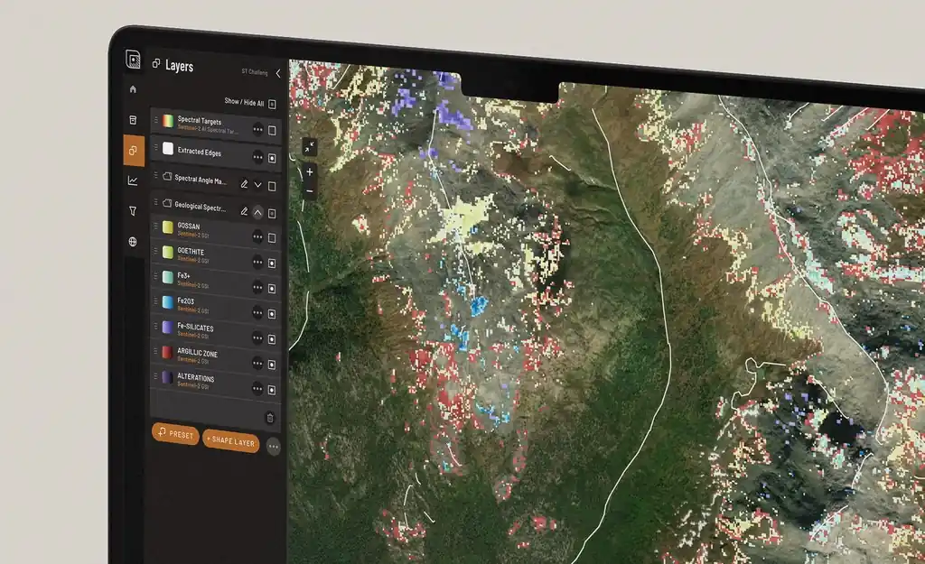
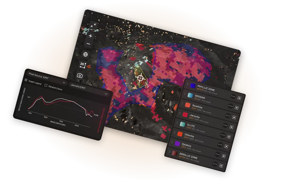
Start with Masking Hub — remove vegetation, water and snow to focus your analysis on exposed ground. Choose your deposit model and load the relevant indicator minerals, then map alteration minerals, iron oxides, clays and carbonates from satellite and hyperspectral sources, with every pixel comparable against the spectral library. Need help choosing? Ask Ignacy.
- Alteration, iron-oxide and clay mapping
- 6,000+ reference spectra to compare against
- Pixel-level curve inspection
Multi-domain, one workspace
See where every signal agrees.
Bring satellite, magnetics, gravity and geochemistry into one registered workspace. A single anomaly might be noise — but where three independent datasets land on the same ground, you have a target worth testing in the field.
- Independent layers registered to the same ground
- Thresholding that leaves only the strong signal visible
- Convergence you can see — and defend
In-platform assistant
Ask your project a question.
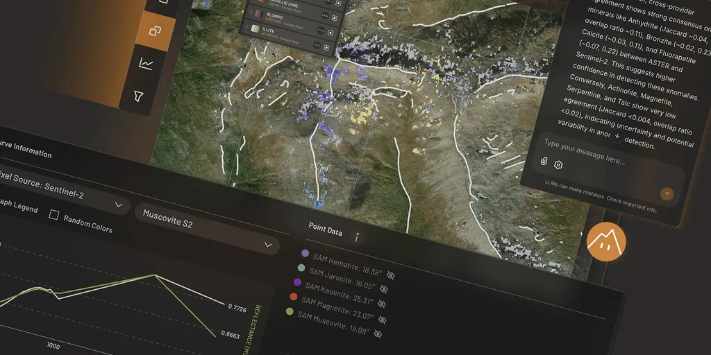
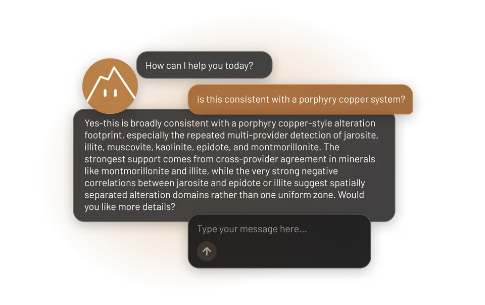
Ignacy, TerraEye's in-app assistant, is the agent manager of an AI team: a geologist, a spectral geologist and a TerraEye guide. Ask about your area in plain language — Ignacy briefs the right specialist, answers grounded in your loaded layers, interacts with the app for you, and generates reports and hotspots on request. It supports interpretation; your geologists make the call.
- Plain-language questions about your AOI
- An AI team of specialists, coordinated by Ignacy (BETA)
- AI reports & hotspots on request
- A starting point, not a verdict
3D & reporting
From map to board-ready evidence.
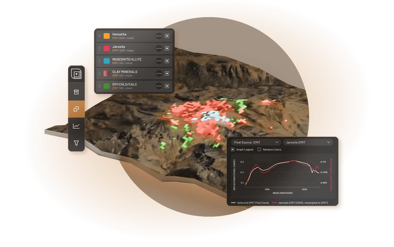
A new 3D engine renders your whole workspace — every layer, not just imagery — in three dimensions. Drape results over terrain to see structure, then export reports, GeoJSONs and GeoTIFFs straight into the GIS you already use.
- 3D terrain visualisation
- Per-target audit trail & rationale
- Shapefile / GeoTIFF / report export
what's inside
The tools you need, in one platform.
Mineral Prospecting (SFF · SAM · GSI)
Match every pixel against the spectral library to map your target minerals.
AI Spectral Targeting
AI-detected anomalies for the minerals you choose: a starting point for your targeting, not a finished target list.
Analogy Lab
Find look-alike ground, validate any candidate's spectral curve against the reference library, and reuse a known signature from one project to hunt analogues in another.
Magnetics & Geochemistry
Load your surveys and point assays as first-class layers beside the satellite — with magnetic transform calculations and visualisation tools, and GeoJSON editing and styling built for surface geochemistry.
Ignacy
Your in-app agent manager: he runs the chat, delegates to his AI team — a geologist, a spectral geologist and a TerraEye guide — interacts with the app for you, and generates reports and hotspots. Your geologists make the call.
Iterate Hypotheses In Minutes
Ask Ignacy to add or drop mineral layers and shift thresholds in bulk, so testing your next hypothesis takes a sentence, not an afternoon of clicking.
Guided Exploration Workflow
A built-in step-by-step panel that walks you from area setup, through cleaning the signal, to a validated, documented target.
Team Access
Seats and viewer roles, shared AOIs and annotations, clean export to your GIS.
Data sources
Data-agnostic by design.
We are spectral-data agnostic: we integrate whichever sensors give the best mineral discrimination for your deposit type and terrain — and bring in the regional geophysical context alongside.
Sentinel-2
First-pass mapping & alteration
ASTER
Fine-grained mineral mapping
EMIT
Advanced discrimination
EnMAP
Hyperspectral detection
PRISMA
Deep spectral discrimination
WorldView-3
High-res target refinement
WYVERN
Next-gen hyperspectral
Global Gravity
Regional density context
EMAG
Global magnetics, regional context
Integrations
Fits the stack you already run.
QGIS
ArcGIS
GeoJSON
GeoTIFF
Leapfrog (planned)
Recent Releases
We integrate every major satellite constellation and pick the combination that gives the best mineral discrimination for your deposit type and terrain.
7 July 2026
v2.4.0
Reuse spectral curves across areas; a guided spectral exploration workflow.
30 June 2026
v2.3.1
Ignacy now works as a team of three role-specialized assistants.
24 June 2026
v2.3.0
Better depth handling for geophysical data; faster map rendering.
2 June 2026
v2.2.1
Drawing Tool v2.0, sharper rendering and a stability pass.